The Karakoram Highway, or KKH, is one of the highest paved international roads in the world. Officially National Highway 35, it runs about 1,300 kilometres from Hasan Abdal in Punjab, through Khyber Pakhtunkhwa and Gilgit-Baltistan, to the Chinese border at Khunjerab Pass and on to Kashgar. Built jointly by Pakistan and China, it was completed in 1979 and opened to the public in 1986. Its mountain scenery, from the Indus gorges to Hunza and Attabad Lake, makes it one of the world’s great road journeys.
In this article
The route, section by section
| Section | Highlights |
|---|---|
| Hasan Abdal – Abbottabad – Mansehra | Green hills of Hazara; now partly bypassed by the Hazara Motorway (M-15) |
| Mansehra – Besham – Dasu – Chilas | The road joins the Indus gorge; steep cliffs and dramatic drops |
| Chilas – Raikot Bridge – Gilgit | Views of Nanga Parbat; the meeting point of three mountain ranges near Jaglot |
| Gilgit – Karimabad (Hunza) | Terraced fields, apricot orchards, Baltit and Altit forts, views of Rakaposhi |
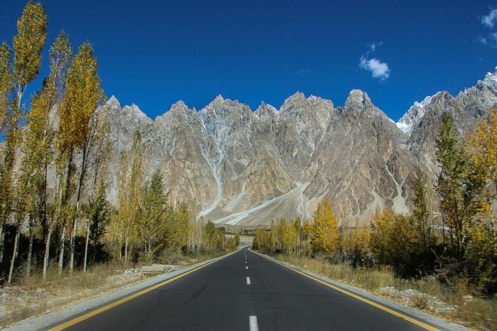
| Hunza – Attabad Lake – Passu – Sost | Turquoise Attabad Lake, Passu Cones, Hussaini suspension bridge |
| Sost – Khunjerab Pass | Khunjerab National Park and the Pakistan–China border |
Khunjerab Pass: the top of the road
At about 4,693 metres, Khunjerab Pass is one of the highest paved border crossings in the world. Visitors from Pakistan can usually drive up from Sost to see the border gate and the snowy plateau, though the air is thin and cold even in summer. The pass is normally open only in the warmer months and closes in winter because of snow, so always check the current status before planning a trip.
Attabad Lake: a new landmark
In January 2010, a massive landslide blocked the Hunza River and formed Attabad Lake, flooding villages and a long stretch of the highway. For several years, travellers had to cross by boat. In 2015, new tunnels built with Chinese help reopened the road. Today the lake’s turquoise water is one of the most visited sights in Gilgit-Baltistan.
When is the best time to travel?
- May to June: clear skies, blossoms in Hunza, pleasant days.
- July to August: warm, but monsoon rains can trigger landslides on the lower sections.
- September to October: autumn colours in Hunza and generally stable weather; often the best time of year.
- November to April: cold, with snow at higher points; Khunjerab Pass is usually closed.

Safety and practical tips
- Check road conditions before leaving and on the way; landslides can close the road for hours or days.
- Carry identification: your CNIC, or passport and visa for foreign visitors. There are several police and army checkposts.
- Do not drive at night on mountain sections; the road is narrow in places, with sheer drops and falling rocks.
- Acclimatise: climb gradually to avoid altitude sickness, and drink plenty of water.
- Cash and fuel: fill up in Gilgit or Aliabad and carry cash; ATMs and fuel are limited further north.
- Mobile signal can be patchy; download offline maps.
- Respect local culture: communities in Hunza and Nagar are welcoming; dress modestly and ask before photographing people, especially women.
How long does it take?
Driving from Islamabad to Hunza (Karimabad) usually takes two days, with an overnight stop in Besham, Chilas or Gilgit. Many travellers prefer to fly to Gilgit or Skardu and continue by road, though flights depend on the weather. In summer, the route through Naran and Babusar Pass is a popular alternative to the lower KKH.
Frequently asked questions
How long is the Karakoram Highway?
About 1,300 km from Hasan Abdal to Kashgar, with roughly 806 km in Pakistan.
How high is Khunjerab Pass?
About 4,693 metres above sea level.
When was the Karakoram Highway built?
It was completed in 1979 and opened to the public in 1986.
Is the Karakoram Highway open all year?
Most of the highway is, but Khunjerab Pass is closed in winter and landslides can block sections at any time.
What is the best time to visit Hunza?
May to October, with spring blossoms and autumn colours the highlights.
Where does the Karakoram Highway start?
At Hasan Abdal in Punjab. It is officially National Highway 35 (N-35) and ends at the Chinese border at Khunjerab Pass.
Is the Karakoram Highway safe to travel?
Thousands of tourists use it every year. The main risks are landslides, falling rocks and tiredness on long days, so check road conditions, avoid driving at night and keep spare time in your plans.
What do I need to visit Khunjerab Pass?
Carry your CNIC or passport, as there are checkpoints, and expect an entry fee for Khunjerab National Park. Crossing into China requires a visa.
How was Attabad Lake formed?
A huge landslide in January 2010 blocked the Hunza River and created the lake, which submerged part of the old road.
Is there mobile signal on the KKH?
Coverage is patchy in the gorges. Download offline maps and tell someone your plans before you set off.